Photo Finish: Washington State Memories!

I’m packing up and organizing my things. The movers come May 3rd and 4th; I’ll be driving out of Washington State for Tennessee by May 7th. As I get ready to move on, I wanted to take a moment and publish a few Photo Finish columns detailing some of the greatest places I’ve seen in this sate during my two years living here.

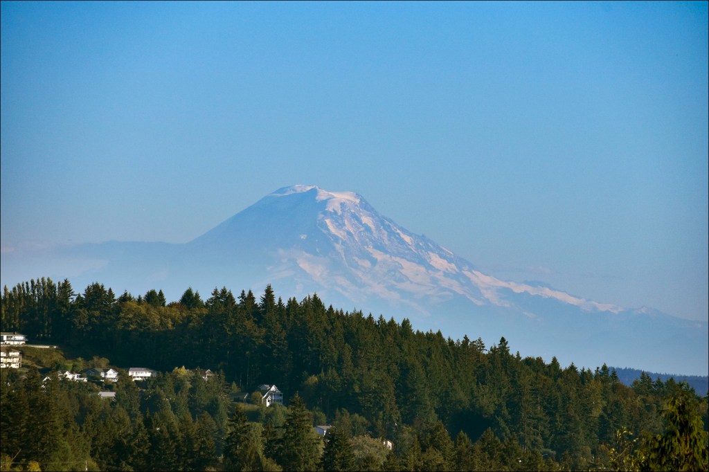
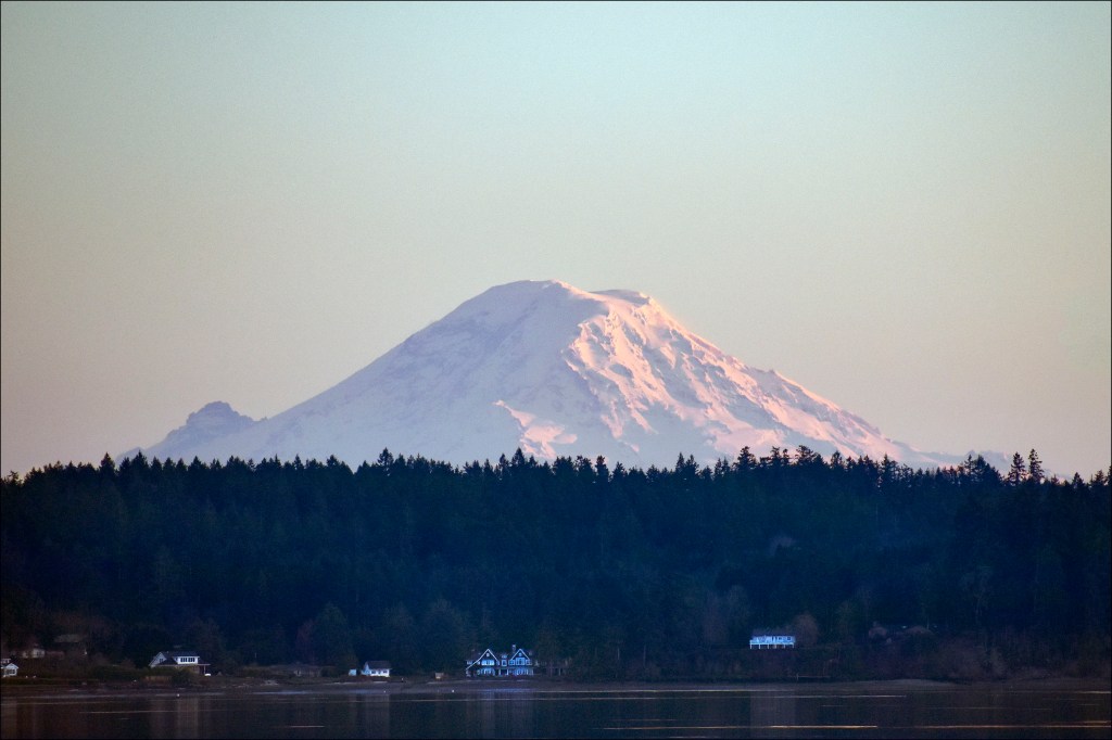
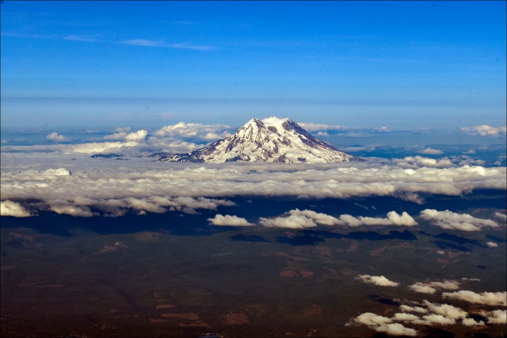
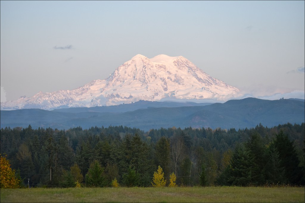
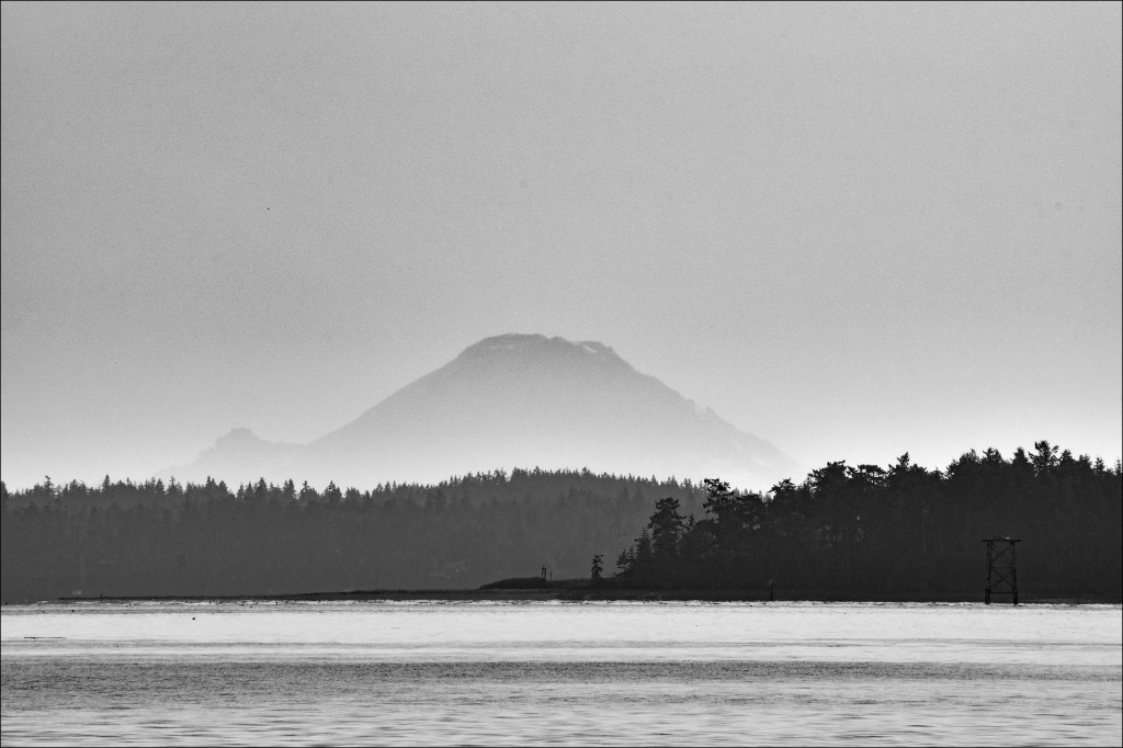
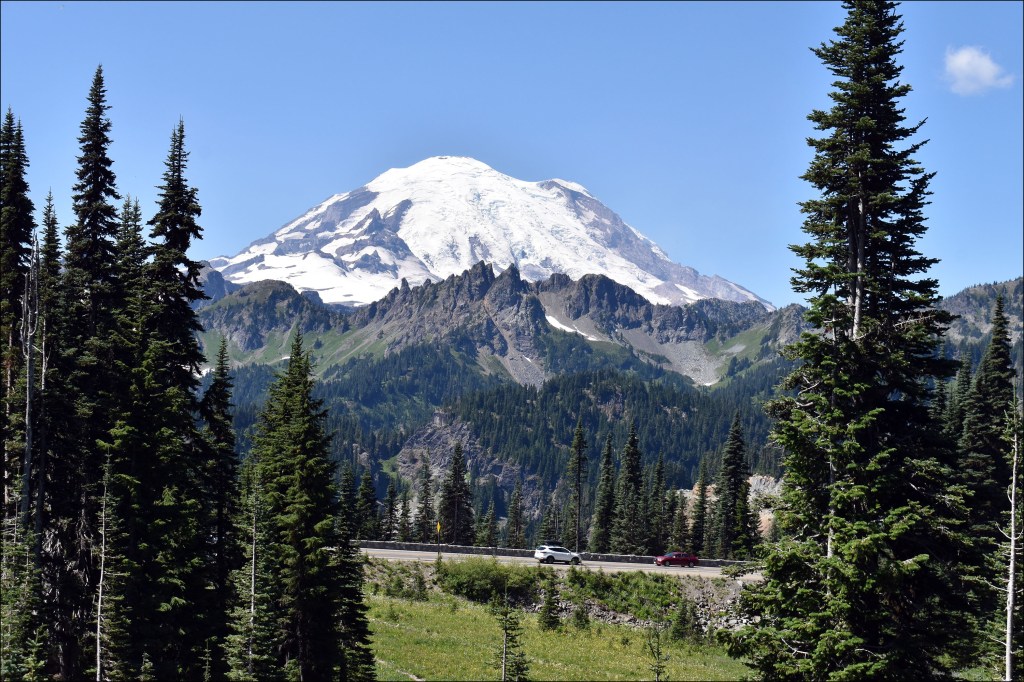
Washington State possesses numerous iconic buildings, locations, and mountains. I reckoned I’d like to start this Photo Finish series by focusing on the BIGGEST iconic object Washington boasts. This is the tallest mountain in the contiguous 48 states, the largest volcano in the Cascade Range, and the image celebrated on Washington State’s primary license plate: Mount Rainier!

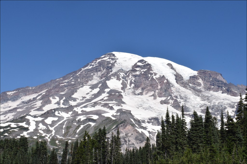
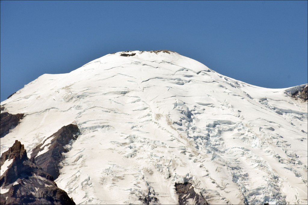
Mount Rainier is a stratovolcano, meaning it’s built of alternating layers of lava and explosive debris. Stratovolcanoes are the ones that create the iconic cone-shaped mountains we see in the movies. Mount Rainier’s roots go back over 2.9 million years, but the present cone towering over Washington is more than 500,000 years old. The mountain surges to a height of 14,411 feet (4,392 meters). The volcano is still active, with up to five earthquakes recorded a month, meaning the magma chamber deep below is still boiling, roiling, and bubbling.

Mount Rainier poses a major threat to the Pacific Northwest, especially the towns in its shadow and cities suck as Tacoma, Olympia, Bremerton, and even Seattle. However, Mount Rainier is also one of the most closely watched volcanoes on the planet, and there are warning systems in place in case the area needs to be evacuated. The last confirmed eruption of Rainier was in the 1850s (small explosions at the summit crater), but eyewitnesses have testified to seeing steam and other minor eruptive activity all the way to the end of the 19th century.

I first visited Washington State in 2018 during my Grand Tour USA, and that’s when I first met what we locally call The Mountain. The national park around the mountain has been my favorite hiking site ever since I moved here in 2019, so let’s take a look back at this magnificent mountain!

I’d seen Mount Rainier many times during my first visit to Washington State in 2018, and had even been hiking on it, but I didn’t get a good, cloud-free photo of the giant for three weeks. This is the first good shot I got of the volcano. Mount Rainier is clearly visible as a ghostly giant even when seen 74 miles away from the town of Poulsbo (trivia: this view was obtained from the parking lot of the Poulsbo Walmart!). Poulsbo, Washington. (Nathanael Miller, 29 September 2018)
I came to Washington to accept an 18-month federal term position as the staff writer for the Naval Undersea Warfare Development Center Division, Keyport, in Keyport, Washington. On good days we could look southeast from the site’s picnic area and see Mount Rainier. I shot this image one morning only seven days after starting work at Keyport. Keyport, Washington. (Nathanael Miller, 14 January 2019)
Mount Rainier seen from the air towering over Washington State. (9 July 2019; Nathanael Miller)
Seen 30 miles form Tanwax Country Chapel, Mount Rainier can be appreciated from one of the best viewpoints ever–a viewing area maintained for the public by Tanwax Country Chapel on its grounds. Eatonville, Washington. (05 Oct. 2019; Nathanael Miller)
Mount Rainier seen 100 miles from Port Townsend. Little Tahoma Peak is the spur seen rising to the left. Port Townsend, Washington. (9 July 2019; Nathanael Miller)
Mount Rainier’s southern face from Paradise. The volcano continues to rise from this point for more than 9,000 feet to the summit. The Paradise area, located at an elevation of 5,400 feet, is one of the most famous and visited areas of Mount Rainier National Park. Mount Rainier National Park Washington. (5 Aug. 2020; Nathanael Miller)
Seen at a distance of nearly 12 miles from Tipsoo Lake, the edge of the Mount Rainier’s summit is covered in glaciers. Mount Rainier National Park Washington. (10 Aug. 2020; Nathanael Miller)
Seen at a distance of nearly 12 miles from Tipsoo Lake, and looking past the jagged remnants of Little Tahoma Peak, is the eastern face of Mount Rainier. Little Tahoma Peak is actually part of Mount Rainier itself; Little Tahoma Peak is the remnant of a much larger version of Mount Rainier that collapsed several thousand years ago. Little Tahoma Peak rises to 11,138 feet (3,395 meters), and would be Washington State’s third highest mountain if it were structure to itself. Mount Rainier National Park Washington. (11 Aug. 2020; Nathanael Miller)

If you’d like to watch a short, but very solid, video on Mount Rainier, check out GeologyHub’s video at: https://www.youtube.com/watch?v=9wRAyQiAcwk&list=PLAQJmRWs6m3sJie_m1RCNiW85KbWH-JHx&index=26&t=1s

Next up on this final photo tour of the Evergreen State: Mount St. Helens!!

###

#nathanaelmiller; #sparks1524; #photography; #photojournalist; #guerrillaphotography; #guerrillaphotojournalist; #beautifuldestinations; #explore; #America; #NPS; #MountRainier; #mountrainiernps; #volcano; #cascades

Leave a Reply

Please log in using one of these methods to post your comment:

WordPress.com Logo

You are commenting using your WordPress.com account. Log Out /  Change )

Twitter picture

You are commenting using your Twitter account. Log Out /  Change )

Facebook photo

You are commenting using your Facebook account. Log Out /  Change )

Connecting to %s