


Continuing my retrospective on my favorite places in Washington State, we now turn to the Evergreen State’s most famous volcano–Mount St. Helens!
A stratovolcano fueled by the Pacific Ring of Fire, Mount St. Helens is part of the Cascade volcanic arc, a chain of volcanoes running from California up into Canada.
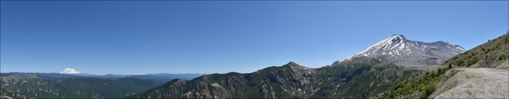
Interestingly enough, Mount St. Helens is actually located slightly west of the main north/south arc of the Cascade volcanoes. It is surmised this is because a series of tiny faults in this area created a weak point in the crust. This weak spot allows the magma generated by the subduction of the Juan de Fuca plate under the North American plate to break through and erupt, forming the mountain.
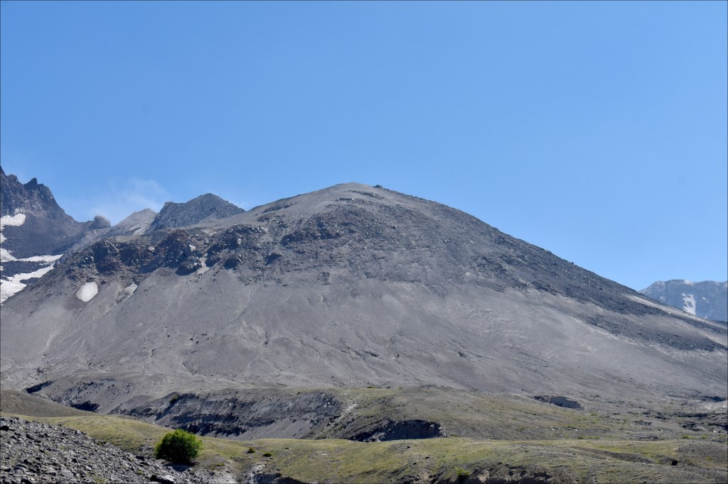
Mount St. Helens is pretty young as volcanoes go; only 400,000 years old. The mountain used to be known as the “Fuji of the West” because it possessed a nearly identical shape to Japan’s famous Mount Fuji until the famous eruption of May 1980. During this event, the entire north face of the mountain collapsed in the biggest terrestrial landslide in recorded human history. The north face was weakened by the growing pressure of magma and gas inside the volcano causing the mountain to swell, creating a massive bulge on the north face. A major earthquake finally caused this compromised area to fail on May 18, 1980. The landslide removed the millions of tons of rock capping the vent, which, in turn, allowed the unimaginable pressure inside the mountain to be released, which then in its own turn, resulted in a the first lateral blast from a volcano observed in real time in recorded human history.
Open a soda bottle, then cap it with your thumb. Shake the bottle up really hard; this represents the interior of the volcano prior to the landslide. Now, quickly pull your thumb away. The agitated gas in the bottle built up pressure while you were shaking it; only your thumb prevented an eruption. Pull the thumb away and BOOM! You just enacted a small-scale model of what happened at Mount St. Helens in 1980 (only Mount St. Helens’ blast went sideways, instead of vertically into the sky).
I was nine years old and living in Washington, D.C., when the 1980 eruption happened. It was one of the first major national news events I remember, right after the 1980 presidential election. I even remember when the ash plume reached the East Coast. For us it wasn’t much more than a mild haze in the sky, but I remember standing, staring at the sky in wonder that a volcano 3,000 miles away could actually affect the other side of an entire continent. My desire to see Mount St. Helens for myself was one of the keys that led to my year-long Grand Tour USA from 2017 – 2018.
The 1980 eruption killed 57 and blasted the landscape into powder. The volcano has erupted several times since, but these were small events defined by steam plumes and the slow, off-and-on-again growth of a lava dome which now stands nearly 1,000 feet high. Grass has reclaimed most of the land, but trees only grow in low elevations were glacier-fed streams provide water. I’m 49 years old now; the 1980 eruption was forty years ago. In the geologic terms the Earth exists in, forty years is but the blink of an eye. Basically, where the Earth is concerned, the major eruption happened yesterday.
Mount St. Helens is still quite active. During periods of somnolence, the U.S. Forest Service allows hikers and climbers onto the mountain itself. When the mountain wakes up, even if the activity is restricted to escaping steam, hiking and climbing are prohibited for safety.


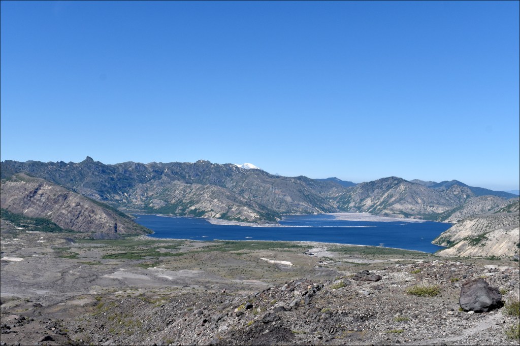


The day I hiked to Loowit Falls, I didn’t realize the falls were technically inside the crater rim until I was inside the crater rim. So, I accidentally hiked right into the crater of an active volcano. How many people can say that?!
Technically, however, Mount St. Helens is the second active volcano I’ve been inside. Most of Yellowstone National Park likes inside the caldera of the very-much active Yellowstone super volcano. Although not projected (or even showing signs) of erupting anytime soon despite over-hyped, end-of-the-world sensationalism in the media, Yellowstone is awake and alive, but its energy is currently best seen in the hot springs and geysers around the national park. Anyway, I visited Yellowstone a few months before my first visit to Mount St. Helens in late 2018, so Yellowstone is the first active volcano I’ve been inside.
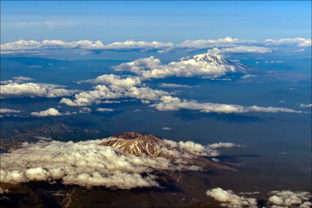
Next up we’ll take a look at the second tallest mountain in the state of Washington: Mount Adams!
###
#nathanaelmiller; #sparks1524; #photography; #photojournalist; #guerrillaphotography; #guerrillaphotojournalist; #beautifuldestinations; #explore; #America; #NPS; #MountRainier; #mountrainiernps; #volcano; #cascades
